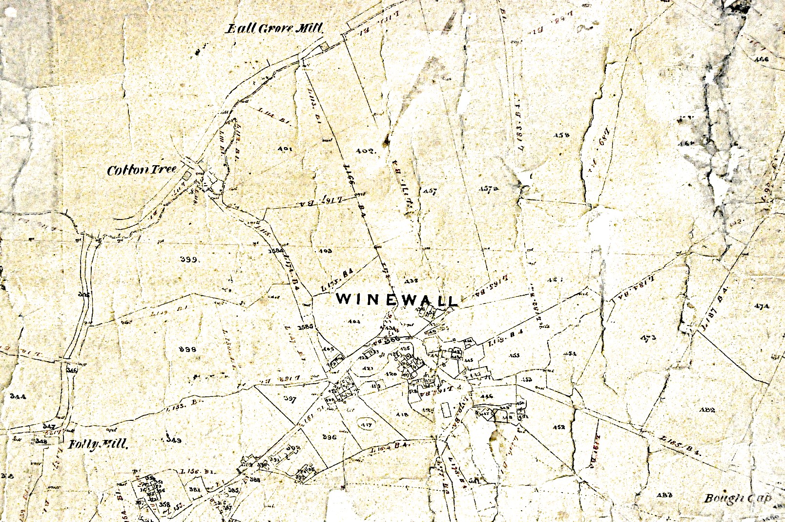
Bough Gap Mill is shown on the Trawden Tithe map which is almost 10ft square and covers Trawden and reaches north to the river at Ball Grove too. It is dated 1844 but was updated to about 1849. Unfortunately the map has localised damage making it hard to read in places. I attach 3 photos I took of the map last year. It numbers every plot and there is an associated tithe index/tithe record book with each landowner, plus tenants and occupiers where appropriate. This should indicate who occupied Bough Gap Mill at that time. The documents are in the Lancashire Record Office at Preston.


I applied to Lancashire Archives for copies of several documents and they arrived on CD quite promptly. I now have the Wills. Thank you for your help.
Best wishes from Redcliffe, Australia
The indexes are quite thick documents and so only photographed those entries I was researching at the time I applied to view them at the Lancashire Archive, Bow Lane Preston.
I think you need to approach the Lancashire archive.
See http://www.lancashire.gov.uk/libraries-and-archives/archives-and-record-office.aspx
Admin
Thanks for the interesting post.
You mention “associated tithe index/tithe record book with each landowner, plus tenants and occupiers where appropriate”. Do you have a copy of the index? I believe my ancestor, Edmund Cockshutt once owned the Mill and would be interested in obtaining any details. If not I understand that I can apply for a copy from Lancashire Archives.