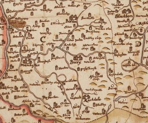
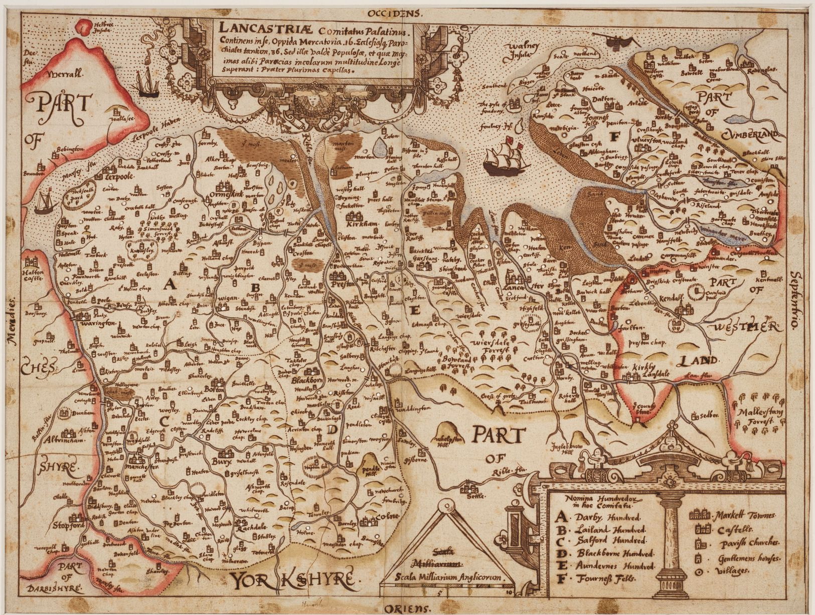
 A unique 17th century map of Lancashire found at John Rylands Library has been placed on display for the first time in 400 years. The Elizabethan hand-drawn document shows well-known places often with a slightly different spelling of their names. There is a pretty key on the right hand side – Blackburn and Colne are shown as market towns but not Burnley, which is depicted as a parish church, while Padiham is shown as a church with a spire. Read and Townley are shown as gentleman’s houses while Hapton deer park is also shown. Clitheroe Castle is also visible and an unlikely shaped Pendle Hill is the largest hill in the county by some margin.
It is thought the map was made between 1602 and 1604 – long before Lancashire became an industrial powerhouse.